LAB-001Aug 2026
Namma Grid
Five centuries of Bengaluru, read from the street grids each era left behind.
- Medium
- illustrated atlas
- Made with
- Astro, SVG, Three.js, View transitions
- Tags
- Cities
- Catalogue
- LAB-001, Aug 2026
- Medium
- illustrated atlas
- Made with
- Astro, SVG, Three.js
What it is
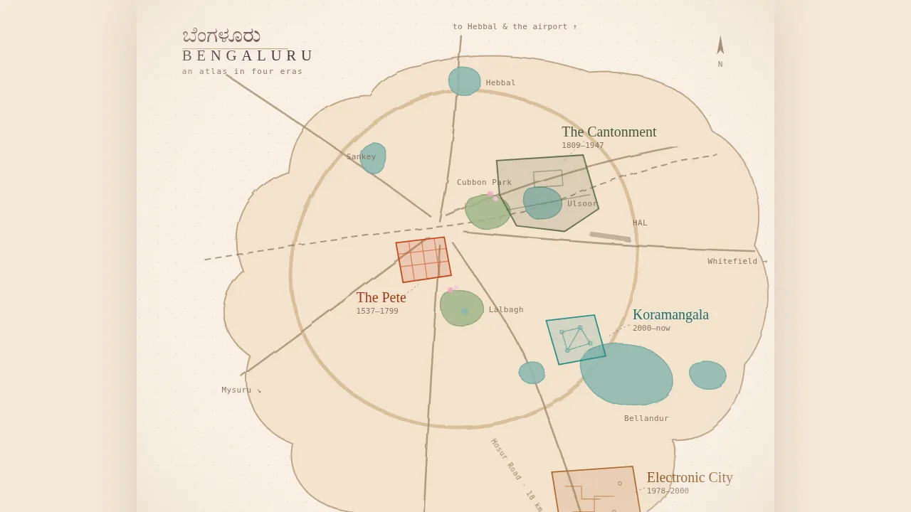
Five centuries of Bengaluru, read from the street grids each era left behind. Four eras sit on one hand‑drawn map: the Pete, the Cantonment, Electronic City and Koramangala. Pick a region and the map opens into its chapter.
How it was made
Astro, with one small Three.js island: a hundred and forty Tabebuia petals falling over an illustrated hero.
The map is hand‑drawn SVG from real geography: the Outer Ring Road, the railway, the lakes, Cubbon Park, the HAL runway. Each region is a real link, so it works with a keyboard and with JavaScript switched off. Chapters open through view transitions, and the region you click becomes the page.
What I learned
The first build followed the spec to the letter: particles assembling into the grid of the Pete, a 3D relief map, glowing beacons, a camera that flew to each era. It worked. I replaced all of it in one commit with a map you can actually read.
The WebGL now does exactly one job, and it is petals.
Credits
- Photos: John Hoey (CC BY 2.0), Vipul ji (CC BY-SA 3.0), Ashwin Kumar (CC BY-SA 2.0), Veera.sj (CC0), Coworker2016 (CC BY-SA 4.0).
- Engraving: Cassell & Co. Postcard: India Post reprint. Photograph: Curzon Collection. All public domain.